Smoky Mountain Maps
Mentioned below are a few of the most popular and/or exciting destinations in the Great Smoky Mountains National Park. All trails are described in round-trip miles. Also, backcountry camping requires a permit.
Park Map
A downloadable PDF that shows location of all park roads, visitor centers, picnic areas and campgrounds.
View NowTrail Map
A downloadable PDF that shows all official trails in the park and indicates location of backcountry campsites and shelters, front country (developed) campgrounds, and primary and secondary roads throughout park.
View NowMap of Region
A downloadable PDF that shows the major highways that provide access to the national park.
View NowCampground Maps
A downloadable PDF that shows location and details for the following developed campgrounds: Abrams Creek, Balsam Mountain, Big Creek, Cades Cove, Cataloochee, Cosby, Deep Creek, Elkmont, Look Rock, and Smokemont.
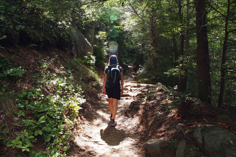
View NowPopular Smoky Mountain Hiking Trails
From waterfalls to wildflowers and breathtaking views, you’ll be able to see it all when you go hiking in the national park. Take a look at some of the best hiking trails in the Smoky Mountains:
| Trail | Length | Difficulty | Description |
|---|
| Alum Cave | 4.4 miles | Moderate | It includes Arch Rock, Inspiration Point, and the Alum Cave Bluff. Inspiration Point offers a spectacular view of the West Prong of the Little Pigeon River. The bluff resulted from Confederate mining of saltpeter during the Civil War. This trail continues to a beautiful viewpoint at the top of Mt. LeConte. The round-trip distance from the parking area to LeConte is 10 miles. |
| Andrews Bald | 4.4 miles | Moderate | This hike heads downslope to a bald with excellent views open to the south and toward Fontana Lake. In the spring, the azaleas explode with color. This trailhead is not accessible by car from Dec. 1 to April 1. |
| Charlies Bunion | 8.0 miles | Moderate | Following the Appalachian Trail, this hike goes out to rocky crags along the state-line ridge. It has excellent views! |
| Chimney Tops | 4.0 miles | Strenuous | It is a steep climb to two rock spires 4,755 ft in elevation. From the top, it provides a spectacular 360-degree view! |
Hikes to Waterfalls
Waterfalls adorn almost every stream in the Smokies. Only one waterfall, Meigs Falls, is visible from the road. It is 12.9 miles west of Sugarlands Visitor Center near the Townsend Wye. All others require hiking and range from easy to strenuous. Check out some of the best Smoky Mountain waterfall hikes below:
| Name of Falls | Length | Difficulty | Description |
|---|
| Abrams | 5.0 Miles | Moderate | The trail begins in the back of Cades Cove Loop Road. Abrams Falls has the largest water volume and is among the most photogenic of all the falls in the park. |
| Chasteen Creek | 4.0 Miles | Moderate | This is a hike starting out of the Smokemont Campground. A small but graceful fall, the hike to this area is well worth it. |
| Grotto | 2.4 Miles | Moderate | Off the Roaring Fork Motor Nature Trail, this trail takes you through a hemlock dominated forest. Grotto Falls is distinctive as it's the only waterfall in the park you can walk behind. |
| Henwallow | 4.4 Miles | Moderate | The trailhead for Henwallow Falls is near Cosby Campground. A less crowded hike, this 45-foot fall receives less visitation than many other area falls. |
| Juney Whank | 0.6 Miles | Moderate | The trail starts near the end of Deep Creek Road near Deep Creek Campground. You won't want to miss this one! |
| Indian Creek | 1.5 Miles | Moderate | This waterfall hike is in the Deep Creek Area. Sliding down 35 feet of sloping rock strata, the water livens and cools the air. Along the route is Toms Branch Falls, another a beautiful fall. |
| Laurel | 2.5 Miles | Easy | The easiest waterfall hike on the Tennessee side of the park, the hike to the 60-foot Laurel Falls follows a paved trail. The trail cuts through the middle of a series of cascades. |
| Rainbow | 5.5 Miles | Moderate to Strenuous | Rainbow Falls, at 80 feet, is the highest single plunge waterfall in the park. This trail makes a good challenge and reveals a beautiful fall. |
| Ramsey Cascades | 8.0 Miles | Strenuous | The trailhead begins in the Greenbrier Area. Ramsey Cascades tumbles over 100 feet among a spectacular setting, creating a magnificent scene. |
Hikes Near Cades Cove
Cades Cove is one of the most-visited spots in the Smoky Mountains and is also one of the best places to go hiking. Here are a few of the best trails to hike in and around Cades Cove:
| Trail | Length | Difficulty | Description |
|---|
| Anthony Creek | Varies | Moderate | This is Cades Cove’s easternmost trail and begins in the Cades Cove picnic area. Vehicles must leave the area 1 hour before sunset. To stay overnight, park by the ranger station. The trail follows Anthony Creek to its headwaters, and after 3 miles, reaches backcountry campsite #9. After another mile, the path merges with Bote Mountain Trail. Destinations include Spence Field, the Appalachian Trail and Rocky Top, one of the park’s best vistas. |
| Cades Cove Nature | 2.0 Miles | Easy | This is a great trail for families. It is less than 1 mile past the Cades Cove Visitor Center and begins along the loop road. The 2-mile loop hike takes about an hour, and you can get a brochure that explains more about the area’s culture and history. Despite its convenience, few people use this easy trail. |
| Cooper Road | Varied | Easy | This little-used trail begins 4 miles from the loop entrance. It was once used for easy access to Cades Cove. It is a level, easy path and ends at the park boundary, but many hikers turn around earlier. |
| Gregory Ridge | 8.0 Mile Loop | Strenuous | The trailhead is on Forge Creek Road. Follow Forge Creek Road 2 miles, and the road ends as a parking lot. The 6-mile trail to Gregory Bald begins here. This tough trip gains 3,000 feet in elevation, and highlights include old growth forest with 8-foot diameter tulip poplars and the 10-acre bald. |
Historic Hikes in the Smokies
If you want to explore some of the history of the Smoky Mountains during your hike, try one of the trails mentioned below. Each of them offers breathtaking views for you to enjoy!
Kephart Prong
The trailhead is located at the footbridge over the Oconaluftee River, 7.0 miles north of the Oconaluftee Visitor Center on the Newfound Gap Road. The first 0.25 mile of trail passes by the site of an old CCC camp and fish hatchery.
Little Greenbrier
Park at Metcalf Bottoms and walk across the bridge to begin the Metcalf Bottoms Trail, and in 0.6 mile, you'll come to the Little Greenbrier School. If you wish, you can continue 1.0 mile from the school to the Walker Sisters' farmstead on the Little Brier Gap Trail. The Little Brier Gap Trail starts at the barricade uphill from the school.
Old Settlers
Follow the road into the Greenbrier area and turn at the bridge toward Ramsay Cascades Trail. Old Settlers Trail starts on the left just after the second bridge. The first 1.5 miles of the trail pass through remnants of the old Greenbrier community.
Old Sugarlands
Park at Sugarlands Visitor Center, and you'll easily find the trailhead. The first 2 miles of this trail offer a glimpse of the old Sugarlands community, which predates the national park. A 6.2 mile loop hike can be achieved by combining Old Sugarlands Trail and Twomile Branch Trail.
Woody House
Follow the Rough Fork Trail from the end of Cataloochee Road for about 1.0 mile to reach the Woody place and its 1880’s home.
Hiking Safety Tips
It is important to be well versed before exploring the backcountry. Here are a few basics to help you get started:
- Always hike with another person.
- Always bring a small flashlight.
- Always bring water.
- All water taken from the backcountry should be treated.
- Let someone know your route and return time.
- Wear appropriate shoes.
- Carry a small first aid kit.
- Check current weather conditions and be prepared for quickly changing conditions.
Leave It There
Whether it be plants, rocks, or animals, please leave it there! Whatever you find in the park is protected for the enjoyment of future generations. It may be easy to rationalize that only one flower that you pick will not hurt anything, but if everyone who visited the park took just one flower there would be none left to enjoy today. More importantly, the seed would be prevented from falling and propagating the species. All plants, including ferns and mosses, are protected. Rocks might be a nice keepsake, but again, they too serve a function.
Most everyone will realize that animals are protected here, and poaching is prohibited. You might not know that feeding the animals is also prohibited to protect not only the hand that is feeding them, but the animals’ well-being as well. All wildlife is protected. Fishing is permitted; however, there are very strict fishing regulations, and you know the rules if you intend to fish.
There is an adage around that goes "take nothing but pictures and leave nothing but footsteps." This is not as true as it used to be because the park wants you to take other's litter, and with increased backcountry visitation, they emphasize low impact camping to minimize the impact of the footsteps left. Please check for information on Low Impact Camping before leaving the trailhead.
- Picking, digging, or otherwise damaging plants is prohibited in the park. Subject to a $5,000 fine and 6 months' imprisonment.
- Persons feeding or disturbing wildlife are subject to a $5,000 fine and 6 months' imprisonment.
- Pets are NOT permitted on park trails, with the exception of the Gatlinburg Trail and the Oconaluftee River Trail. They must be on a leash at all times at campgrounds, picnic areas, and other developed areas.
- Camping is permitted only in designated sites.
Being Bear Aware
Black bears in the park are wild, and their behavior is sometimes unpredictable. Although extremely rare, attacks on humans have occurred, inflicting serious injuries and death. Treat all bear encounters with extreme caution and follow these guidelines:
Encounters Along the Trail
Remain watchful. If you see a bear at a distance, do not approach it. If your presence causes the bear to change its behavior (stops feeding, changes its travel direction, watches you, etc.) – YOU’RE TOO CLOSE.
Being too close may also promote aggressive behavior from the bear, such as running toward you, making loud noises, or swatting the ground. The bear is demanding more space. Don’t run but slowly back away while watching the bear. Try to increase the distance between you and the bear. The bear will probably do the same.
If a bear persistently follows or approaches you, typically without vocalizing, or paw swatting, try changing your direction. If the bear continues to follow you, stand your ground. If the bear gets closer, begin talking loudly or shouting at it. Act aggressively, and try to intimidate the bear.
Act together as a group if you have companions. Make yourselves look as large as possible (for example move to higher ground). Throw non-food objects such as rocks at the bear. Use a deterrent such as a stout stick if you have one. Don’t run and don’t turn away from the bear.
Don’t leave food for the bear; this encourages further problems. Most injuries from black bear attacks are minor and result from a bear attempting to get at people’s food. If the bear’s behavior indicates that it's after your food and you’re physically attacked, separate yourself from the food and slowly back away.
If the bear shows no interest in your food and you’re physically attacked, fight back aggressively with any available object — the bear may consider you as prey! Help protect others, report all bear incidents to a park ranger immediately! Above all, keep your distance from bears!
Encounters in Camp
The best way to avoid bears is to not attract them. Keep cooking and sleeping areas separate. Keep tents and sleeping bags free of food odors; do not store food, garbage, or other attractants (i.e., toothpaste, soap, etc.) in them.
A clean camp is essential to reducing problems. Pack out all food and litter; don’t bury it or try to burn anything. Proper food storage is required by regulation. Secure all food and other attractants at night or when not in use. Where food storage devices are present, use them; otherwise, place all odorous items in your pack.
Select 2 trees 10-20 feet apart with limbs 15 feet high. Using a rock as weight, toss a rope over a limb on the first tree and tie one end to the pack. Repeat this process with the second tree. Raise the pack about 6 feet via the first rope and tie it off. Then pull the second rope until the pack is up at least 10 feet high and evenly spaced; it must be 4 feet or more from the nearest limb.
Garbage Kills Bears!
- Secure all food, toothpaste, soap, and trash at night or when not in use.
- Do not cook or store food in or near your tent.
- Pack up ALL your trash, don’t bury or burn anything!
- If a bear approaches you, frighten it by yelling, banging pans together, or throwing rocks.